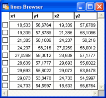
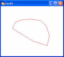
Creates line objects (two nodes) from database columns. The table containing line information needs at least four numeric columns with coordinate values and has to be mappable. Datasets with coordinate values=0 will be ignored.
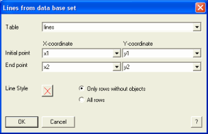
1.Select the Lines from Table function.
2.Choose a table or selection to complete with line objects. Choose the four columns for X- and Y-coordinates of the initial and end point.
3.Define a Line Style for the new objects
4.Only rows without objects: Create only new objects for datasets and attach them to existing data.
All rows: Overwrite all graphical objects and create a new line for every dataset.