Add nodes to a line segments with fixed distances and using a defined number of segments.
Supported object types: Line, Polyline, Polygon/Region, Rectangle
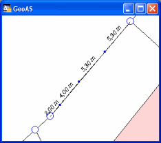
Result objects are polyline or region objects.
1.Select the object you want to process.
2.Select the Segmenting function. (The shape of the cursor changes to a crosshair cursor.)
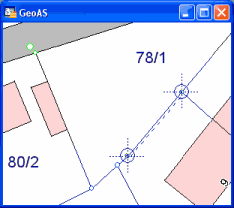
3.Create a 2-point construction line to the edge you want so add nodes. Use the snap mode.
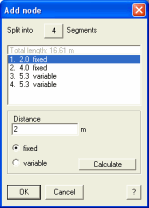
Total length: The total length of the processed line is displayed as basic information (not the virtual digitized line).
Enter the number of segments you want to split.
Define fixed distances or calculate variable distances based on the number of segments. Press Calculate to resume into the listbox.