Supported object types: All (excluding Point, Text)
1.Select one or more objects from the editable layer.
2.Select the Scale function.
3.Specify the anchor point in the map window for scaling. If you want to use the object center or coordinates from table columns, just click anywhere in the map window.
4.Select the anchor point: you can choose between the object center, the selected point (where you clicked in the map window) or a point, whose coordinates are written in the database of the selected object. In the last case you have to select the columns containing the coordinates from the drop-down lists.
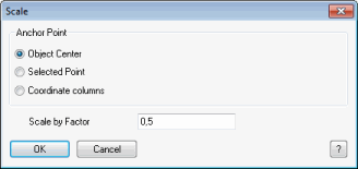
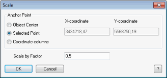
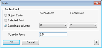
MapCAD scales every object relative to the anchor point. If the factor is 0.5, for example, the size of the objects as well as the distance from the anchor point is divided by two. The shape of the objects remains unchanged.
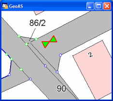
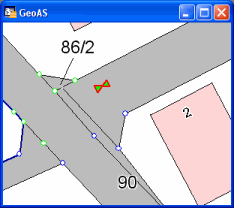
Example: The size of a traffic sign symbol is supposed to be half the size of the original symbol (factor 0.5). The lower end of the line has to remain at the same place, so this end is chosen as anchor point.