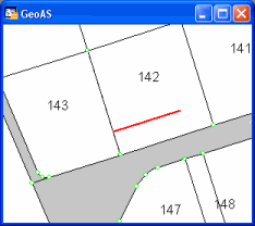
Creates a new line object along the approximated predefined direction at a 90 degree angle to the chosen object.
Supported object types: Line, Polyline, Region
New Object: Line
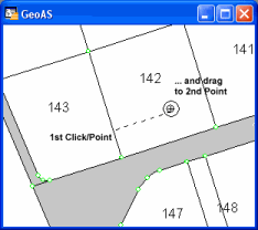
1.Select the Right Angle function. (The shape of the cursor changes to a crosshair cursor.)
2.Digitize a line that is approximately at a 90 degree angle to the desired object. The object must be within the snap tolerance.
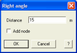
3.Enter the length of the new line. Optionally, add a new node at the intersection point to the chosen object.