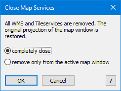
 This function closes all map services (for example Bing, WMS) in one or all map windows and returns the projection and calculation method (cartesian / spherical) of the map window to plausible values.
Background: When adding a map service, the map window projection is adapted to the needs of map service. If the map service is removed via the layer control or closed, the projection will not be reset. This can lead to unwanted results when accessing coordinates, areas and lengths.
This feature not only removes map services, but also returns the map window projection and calculation method to the settings that correspond to the topmost native layer in the map window.
