Digitize a polyline entering the distance and angle of each node.
1.Select the Traverse Line function. (The shape of the cursor changes to a crosshair cursor.)
2.Snap to an end-point of an existing line. Optionally, you can digitize a new line: Snap to an existing line or polyline by pressing the mouse button and dragging in the desired direction. In this case, the angle and length of the digitized line are entered as the first line segment. The direction of the chosen line is automatically calculated and added to the dialog entry.
3.Enter new line segments defining the angle and the distance.
Optionally, you can adjust the drawing with the: +/- Degree (addition), Starting Point is end of line, add angle after creating, Combine to polyline. Use Traverse Line to generate line segments continuously based on the current settings. The result is a polyline.
|
•Mathematical angles are other clockwise (enter negative values for the opposite). •If the option Metes and Bounds is enabled the +/- option will be disabled, because of different orientations. |

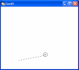
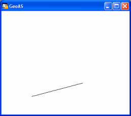
freehand drawing
|
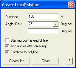
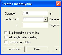
corresponding information
|
type in desired values
|
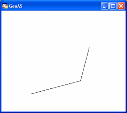
corresponding drawing
|
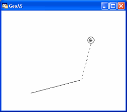
extend drawing
|
corresponding information
|
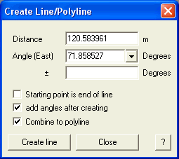
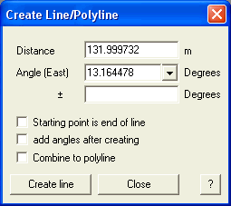
type in desired values
|
corresponding drawing
|