The options allow additional elements to be placed on the print page. The elements can be placed outside the map frame in the header / footer of the page or at the top / bottom of the map frame. They can be aligned left, center, or right on the page.
The selection of elements is done via 12 drop downs on the dialog box.
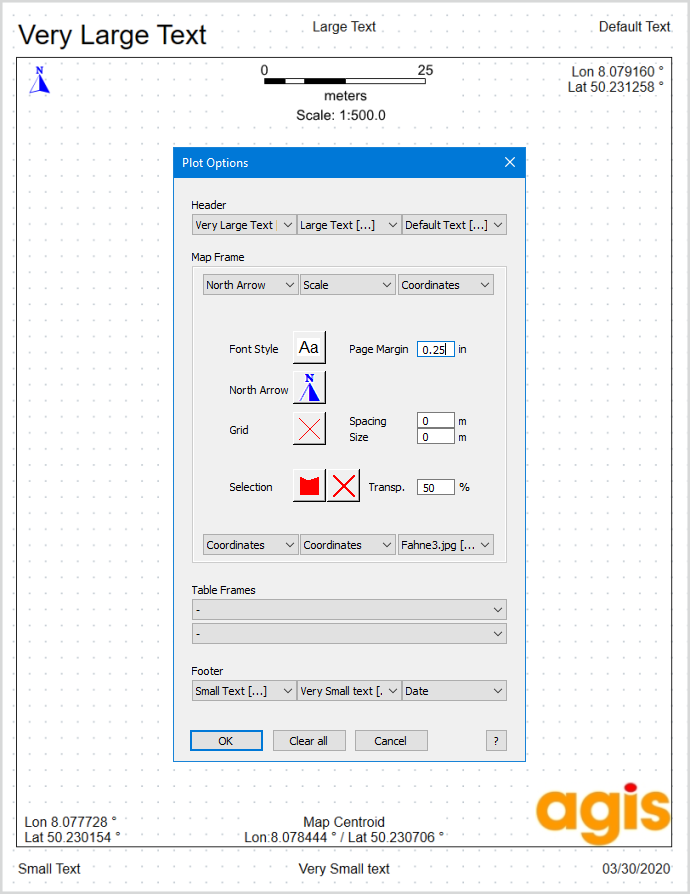
Drop downs
Insert static or dynamic texts on the print page. Selecting the entry Text [..] opens a dialog for entering text.Font type and font size Line feed
1. Individual textInput of any one or more lines of text.
2. Text from query result based on a tableIf objects have been selected in the map window, database attributes for an object can be inserted as text on the print page. The matching SQL statement is entered in the text field for this purpose.Example: Parcels are selected in the map window. In a text field, a SQL statement (SELECT ...) is entered. As soon as the layout is created, the SQL statement is executed and the values are determined from the table - per selected object, so it also works in the case of several previously selected objects in the merge. The values will be inserted as text on the print page to the chosen text position (1 - 12). The condition for the SQL statement is that only one column is returned per text. So no comma may be included as a column separator. Multiple columns can be connected with "+" or "&". The FROM clause at the end of the SQL statement is optional. If a table is specified, a corresponding message appears before execution, unless the selected objects are from this table. If no FROM clause is specified, it checks to see if the SQL statement contains consistent columns. SQL statements may also be more complex and produce a multi-line result.
3. Text from Keyword
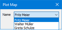
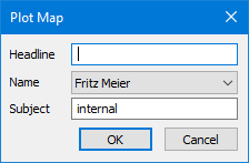
A special feature is the dialog keyword #Dialog.Label = Default#, which causes an input dialog to appear when the layout is created.
#Dialog.Name=Meier#
#Dialog.Name=Fritz Meier;Walter Müller;Greta Schulze#
#Dialog.Headline=# |
Insert logos, stamp fields, graphics or photos on the print page Choose the entry Image file [..] to enter a file name and define the image height in the print page. If these setting should be stored in a template, the image file should be located in a global accessible directory. |
Insert the scale on the print page. The scale number, the scale bar or both can be displayed within the map frame. Outside the frame, only the representation of the scale number is possible.
|
Insert the current date as text on the print page. |
Insert a north arrow on the print page. The arrow icon comes from a TrueType font and is set with the button in the middle of the Options dialog box. Depending on the angle of rotation, the north arrow is displayed accordingly. |
Insert the corner and center coordinates of the map frame on the print page (using the current map projection). With the left and right drop downs, the corresponding corner coordinates are inserted. With the middle drop downs the center coordinates are inserted. |
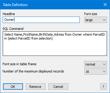
Syntax: Select COLUMNLIST from TABLE where KEY in (select KEY from selection)
Example:
Separate font sizes can be selected for the heading and the table content. The number of displayed data records can be limited so that the table frame does not extend beyond the page. The height of the map frame is always calculated dynamically based on the number of data records actually displayed. |
Global Settings
Choose then default Font Style and Font Size. This default setting will be used for all texts in the print page that are inserted. Optionally, the text size for individual texts and texts from a query result can be changed from normal to larger or smaller. |
Choose then default Font Style and Font Size for the North Arrow symbol. Only real true type fonts can be used. |
Creates grid crosses or grid lines within the map frame of the printed page. Line style, Spacing and Size define the crosses. If the spacing and size are identical, grid lines are created instead of crosses. With rotated maps, the grids are displayed rotated accordingly. If no grid crosses / grid lines are desired set Spacing and Size to Zero. |
Defines the style of the selected objects in the map frame of the print page. The style can be chosen freely and does not depend on the selection style in MapInfo |
Defining the printable area on the paper. This setting is used for all four margins and can be used in addition to the printer-specific margins. |

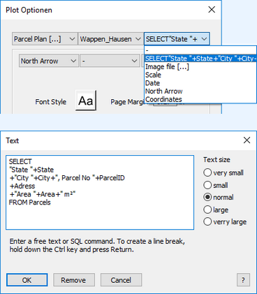
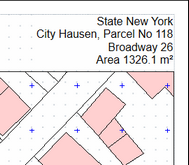
 With the keywords, several values can be displayed together in one continuous text. Free texts (without "") and line breaks are permitted. Select commands are also permitted here.

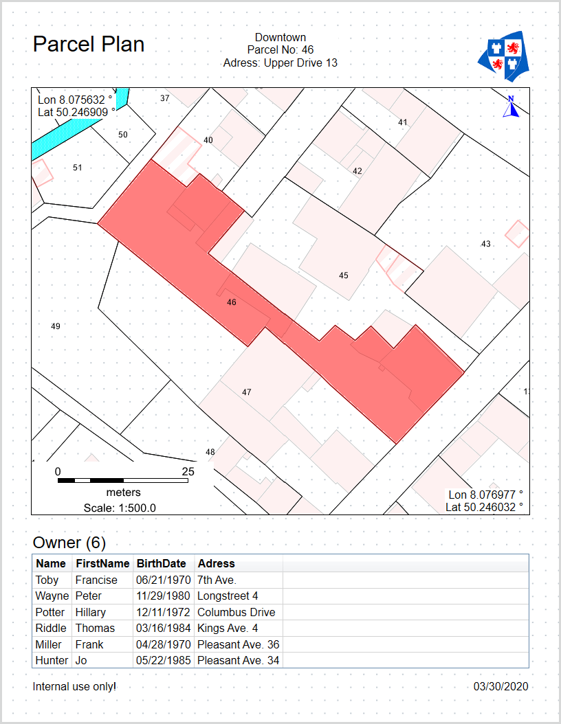 Up to two table frames can be inserted in a plot layout. The table content is generated using a standard SQL command. Queries in subtables using a nested select statement are also permitted (no dynamic links). Prerequisites are pre-selected objects to which the query refers.