 Objects can be labeled with information about their geometry (coordinates, length, area) and / or with the attribute values set in the layer control. The label is a static text object in the cosmetic layer. Changes to the object do not track the label. Coordinate values are determined in the projection of the map window.
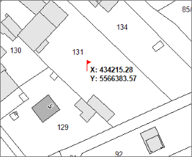
Activate the tool button and click in the map window on the place where the label should be inserted.
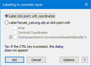
Label click point with coordinates
At the click point, a text object with the coordinate values is inserted into the cosmetic layer (optionally with symbol).
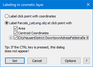
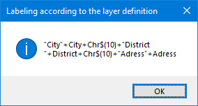
Label MyLayer.obj at click point with
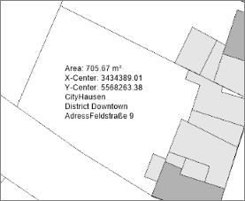
At the click point, the topmost selectable object is determined and its attributes are inserted as a text object in the cosmetic layer.
In addition to the graphic attributes (coordinates / length / area, depending on the object type), the layer-specific column attributes (autolabel) can also be inserted. The current column values are displayed on the dialog. A change is possible via the Layer Control -> Layer Properties -> Label Display.
Options
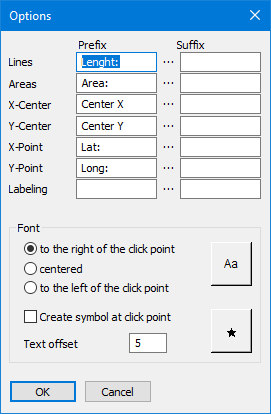
before / after: The text object can be completed with text additions in front of and behind the text (example: area: 456.67 qm).
Font: Font and label position (left / zenrtriert / right)
Insert a point symbol at the click point: This option places the chosen symbol at the click point and also the text object. Otherwise, only the text object is placed.
Distance to Point: Defines the distance between the click point and the text object.